Service
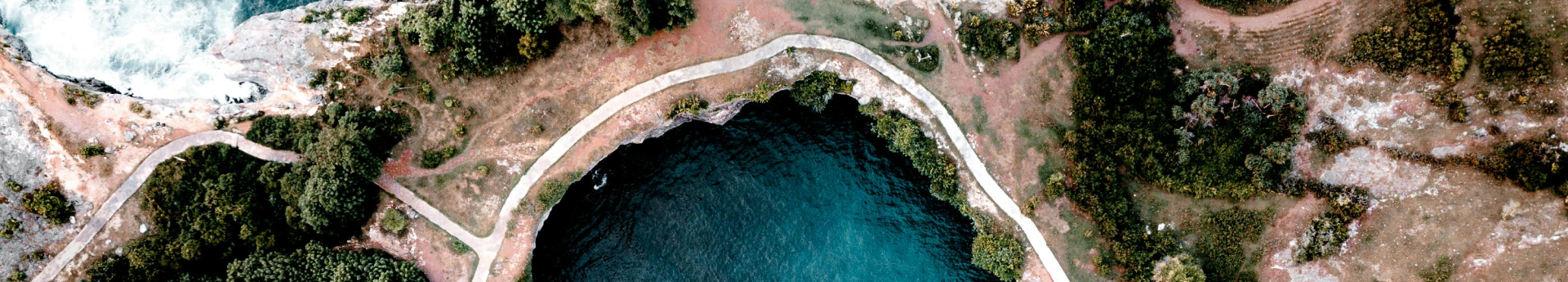
Drone, a leading provider of cutting-edge mapping services, utilizes state-of-the-art drone technology to offer accurate and efficient mapping solutions for various industries. Leveraging the capabilities of unmanned aerial vehicles (UAVs), Drone has revolutionized the way mapping and surveying tasks are conducted across sectors such as agriculture, construction, infrastructure management, environmental monitoring, and more.

Best solutions from your company
Experience the pinnacle of innovation and excellence with our company's best-in-class solutions for all your drone needs.
Aerial Photography Services
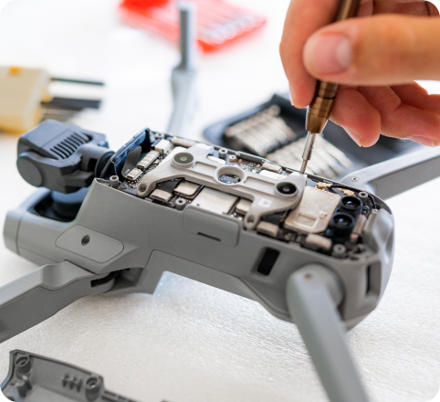
Advanced Drone Technology: Drone employs the latest advancements in drone technology, including high-resolution cameras, LiDAR (Light Detection and Ranging) sensors, GPS (Global Positioning System), and onboard computing capabilities. These drones are specifically designed and equipped to capture detailed aerial imagery and data with precision.
Customized Flight Planning: Before each mission, Drone conducts thorough planning to determine the optimal flight path and parameters based on the client's requirements. This includes defining the area to be mapped, altitude, speed, and flight patterns to ensure comprehensive coverage and accurate data collection.
Data Acquisition and Processing: During the flight, the drone captures high-resolution images and/or LiDAR data of the designated area. The captured data includes visual imagery, elevation information, and other relevant geospatial data. Drones advanced software algorithms then process this raw data to generate detailed maps, 3D models, orthophotos, and point clouds.
Precision Mapping and Analysis: Once the data processing is complete, Drones team of skilled GIS (Geographic Information System) specialists and data analysts conduct thorough quality checks and validations. They meticulously analyze the mapped data to ensure accuracy and identify any anomalies or discrepancies.
Process
Planning and Preparation
- Identify the project objectives and define the area to be mapped.
- Conduct a site survey to assess factors such as terrain, obstacles, and airspace regulations.
- Determine the optimal flight path, altitude, and camera settings for capturing high-quality aerial imagery.
Data Acquisition
- Identify the project objectives and define the area to be mapped.
- Conduct a site survey to assess factors such as terrain, obstacles, and airspace regulations.
- Determine the optimal flight path, altitude, and camera settings for capturing high-quality aerial imagery.
Data Processing and Analysis
- Identify the project objectives and define the area to be mapped.
- Conduct a site survey to assess factors such as terrain, obstacles, and airspace regulations.
- Determine the optimal flight path, altitude, and camera settings for capturing high-quality aerial imagery.
Deliverables and Reporting
- Identify the project objectives and define the area to be mapped.
- Conduct a site survey to assess factors such as terrain, obstacles, and airspace regulations.
- Determine the optimal flight path, altitude, and camera settings for capturing high-quality aerial imagery.
Affordable Service Packages
- 5-week training program covering basic flight skills, safety guidelines, and regulations.
- Hands-on practice sessions with experienced instructors.
- Access to online resources and training materials.
- Certificate of completion upon finishing the program.
- Price: Starting at $299
- 5-week training program covering basic flight skills, safety guidelines, and regulations.
- Hands-on practice sessions with experienced instructors.
- Access to online resources and training materials.
- Certificate of completion upon finishing the program.
- Price: Starting at $299
- 5-week training program covering basic flight skills, safety guidelines, and regulations.
- Hands-on practice sessions with experienced instructors.
- Access to online resources and training materials.
- Certificate of completion upon finishing the program.
- Price: Starting at $299